Construction Site Surveys and Progress Evaluation
The Benefits of Using Drones in Construction Site Surveys and Report Generation
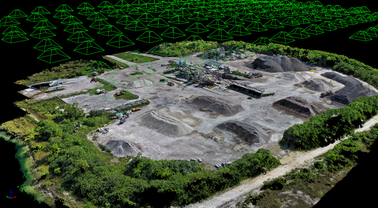
The construction industry is continually evolving, embracing technological advancements that enhance efficiency and accuracy. One of the most transformative innovations is the use of drones for site surveys. Drones not only streamline the data collection process but also provide a variety of reporting options that support project management and decision-making. Let’s explore the benefits of using drones in construction site surveys and the types of reports that can be generated.
Benefits of Using Drones in Construction Site Surveys
Increased Efficiency
Drones can cover vast areas in a fraction of the time required for traditional surveying methods. While ground crews may take days or weeks to gather data, drones can accomplish the same tasks in a few hours. This rapid data collection helps keep projects on schedule and allows for quicker adjustments when necessary.
Enhanced Accuracy and Precision
Equipped with advanced imaging technologies like LiDAR and photogrammetry, drones provide highly accurate measurements and detailed 3D models of construction sites. This accuracy minimizes the risk of errors in planning and execution, ensuring that project stakeholders have reliable data for decision-making.
Cost Savings
By reducing the need for extensive ground surveys, drones help lower labor costs and save time. Furthermore, the early identification of potential issues through aerial surveys can prevent costly rework and delays, ultimately leading to significant cost savings.
Safety Improvements
Drones can access hard-to-reach or hazardous areas, reducing the risk to workers on the ground. By using drones to conduct surveys in these environments, companies can enhance safety measures while ensuring compliance with regulations.
Real-Time Data Collection
Drones enable real-time data acquisition, allowing project managers to monitor progress continuously. This instant feedback facilitates timely decision-making, helping to address issues as they arise and keeping projects on track.
Comprehensive Site Analysis
Drones capture high-resolution images and videos that provide a thorough overview of the construction site. This visual data is essential for assessing site conditions, monitoring environmental impacts, and documenting progress throughout the project lifecycle.
Improved Communication and Collaboration
The visual reports generated from drone surveys can be easily shared with team members, clients, and stakeholders. This transparency fosters better collaboration and keeps everyone aligned on project goals and progress.
Types of Reports Generated from Drone Surveys
Drones can produce a variety of reports that support different aspects of construction project management. Here are some of the most common types:
Site Survey Reports
These reports include detailed maps and 3D models created from aerial imagery. They provide essential topographical data, helping teams assess land features and plan construction activities accordingly.
Progress Monitoring Reports
Drones can generate periodic progress reports that document construction milestones. These reports typically include comparative images over time, allowing project managers to visualize progress against timelines and budgets.
Volume Calculation Reports
Using drones, teams can calculate the volume of materials on-site, such as earthworks or stockpiles. This data is critical for inventory management and cost estimation, providing accurate figures for billing and resource allocation.
Inspection Reports
Drones are excellent for conducting inspections of structures and hard-to-reach areas. Inspection reports highlight potential issues, such as structural damage or safety hazards, and can be enhanced with annotated images for clarity.
Environmental Impact Reports
These reports assess the environmental effects of construction activities. Drones can monitor vegetation, water sources, and wildlife, ensuring compliance with environmental regulations and promoting sustainable practices.
Safety Assessment Reports
By documenting site conditions and worker activities from above, drones can help generate safety assessment reports. These reports highlight compliance with safety standards and can be used for training purposes.
As-Built Documentation
Drones can capture comprehensive data of the completed project, producing as-built documentation that reflects the final conditions. This information is invaluable for future maintenance, renovations, or legal purposes.
Conclusion
The integration of drones into construction site surveys brings a host of benefits, from increased efficiency and accuracy to improved safety and cost savings. The various reports generated through drone technology provide actionable insights that enhance project management and decision-making. As the construction industry continues to embrace this innovative tool, the potential for optimized workflows and enhanced project outcomes will only grow. Drones are not just a technological novelty; they are a vital asset in modern construction practices.


